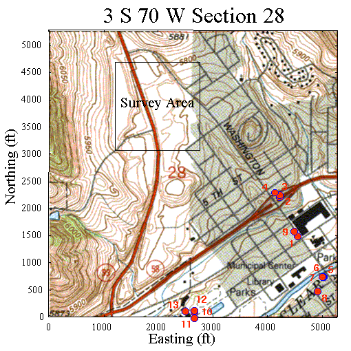
Well Information Near Survey Area
The map and table shown below were generated from information gathered from the Colorado Division of Water Resources. Included in this map are all located wells within section 28 of township and range 3 S, 70 W - the section enclosing the survey area. The tabulated information includes well location specified as a distance in feet from the indicated section boundary, total well depth in feet, and water depth - if the well hit water.

| Number | Well Coordinates | Well Depth (ft) | Water Depth (ft) |
|---|---|---|---|
| 1 | 1500S,0750E | 35 | 25 |
| 2 | 2227S,1073E | 57 | 48 |
| 3 | 2263S,1067E | 60 | 46 |
| 4 | 2300S,1155E | 59 | 47 |
| 5 | 0764S,0258E | 15 | |
| 6 | 0762S,0284E | 15 | |
| 7 | 0752S,0301E | 15 | |
| 8 | 0497S,0387E | 34 | |
| 9 | 1600S,0800E | 23 | |
| 10 | 5190N,2640E | 31 | |
| 11 | 0000S,2640W | 25 | |
| 12 | 5140N,2640E | 17 | |
| 13 | 5160N,2800E | 20 |
