Survey Coordinates
We will define positions within the survey area by using x, y coordinates. Coordinate x represents the position of the point in the east-west direction, and coordinate y represents the position of the point in the north-south direction. Both are measured in meters from the exact center of the survey area. Thus, the 500 x 500 m survey area containts points that vary in x, y location from -250 m to 250 m.
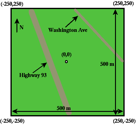
On the figure shown above, the x, y coordinates of each of the four corners of the survey area are shown as (x,y). Thus, the southeast corner of the survey area has the coordinates (250,-250).
The geographic coordinates of the survey area are as follows:
- (-250,250) = 39.7667 degrees N, 105.237 degrees W
- (250,250) = 39.7667 degrees N, 105.222 degrees W
- (-250,-250) = 39.7621 degrees N, 105.237 degrees W
- (250,-250) = 39.7621 degrees N, 105.222 degrees W
The elevation of the entire survey area is approximately 5800 feet above sea level.